WAKEATLAS / PORTS

60 port profiles · each selection has its own shareable address

Arrecife

Harbour-area cameras, port facilities and nearby AIS observations.

Canarias, Spain

Nearby vessel reports

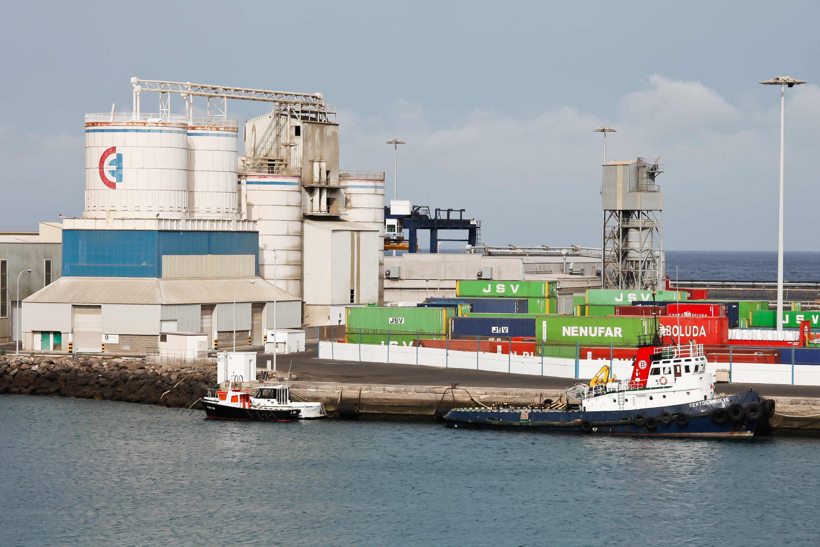
Tugboats alongside containers and industrial facilities in Arrecife harbour.
Working waterfront at Los Mármoles, Arrecife, in 2011. · 25 August 2011. Photograph by Luis Miguel Bugallo Sánchez (Lmbuga), CC BY-SA 3.0, via Wikimedia Commons. Dated photograph, not a live view.

From reef shelter to trading port

Arrecife began as a small fishing settlement, recorded in the fifteenth century. Its name refers to the volcanic reefs that sheltered boats along this part of Lanzarote’s coast. The natural protection helped establish the settlement’s maritime role.

By the late sixteenth century, expanding trade created demand for warehouses and accommodation. The growing port also faced attacks: a raid in 1571 devastated the settlement. Fishing, commerce and the need to defend the waterfront are intertwined in the town’s early history.

The photograph shows the working port at Los Mármoles in August 2011, with cargo containers, industrial facilities and harbour vessels. It is a dated record of the commercial waterfront, distinct from the live camera view.

Explore the original records

Arrecife Cruise Port, Lanzarote

Watch the harbour using the player below without leaving this page.

Powered by World Port Cams. Press Play to start. Camera availability and playback controls are managed by the provider; images may be unavailable or delayed. Any weather shown by the player is forecast information.

All published port profiles